Sedona MTB Guide: Red-Rock Trails, Hangover & Hi-Line
Sedona's red-rock singletrack is one of the most photographed riding zones on the planet, but the network rewards riders who time the shoulder seasons and pick their lines on Hangover, Hi-Line and the Hogs carefully.
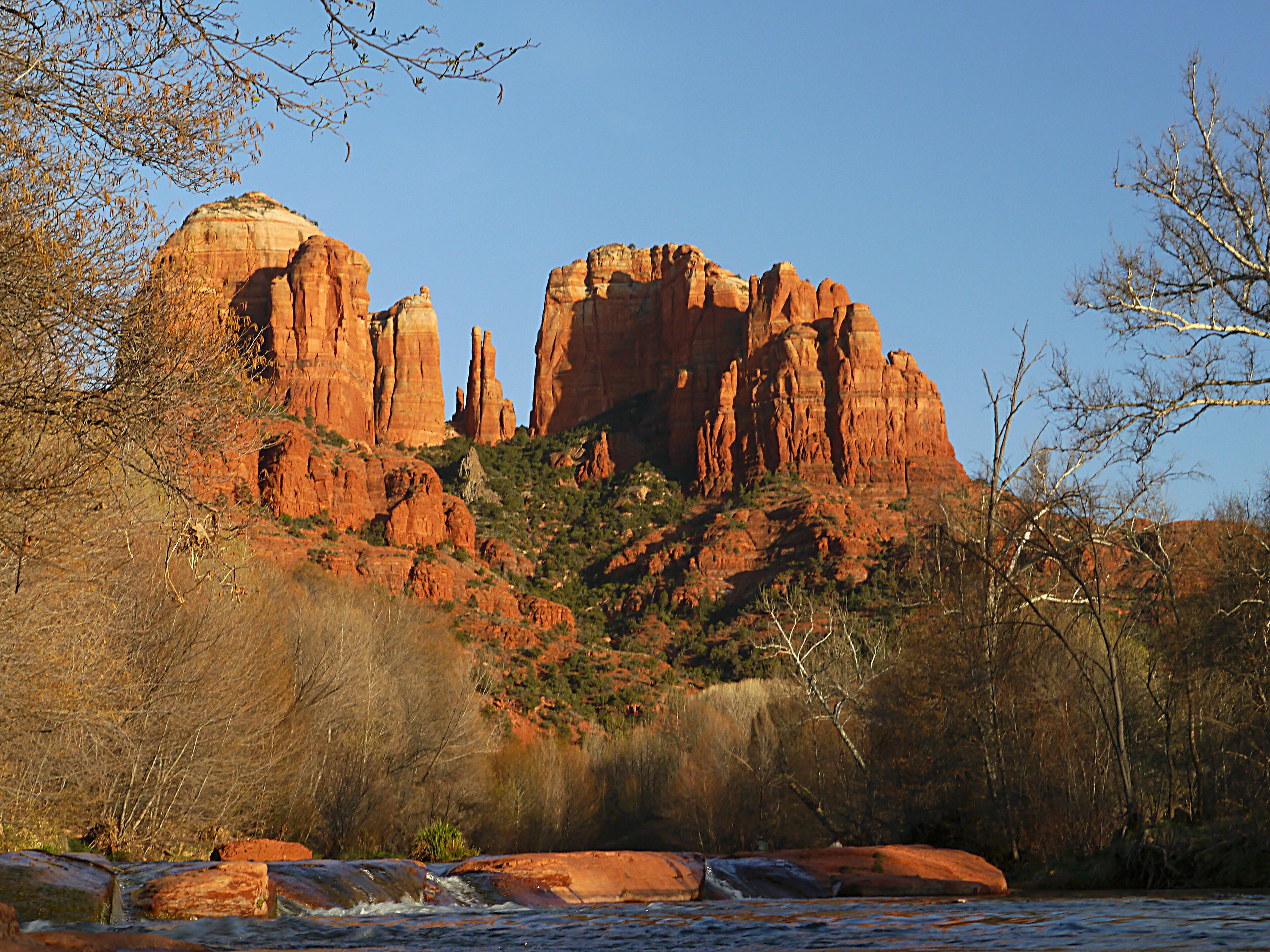
The traverse above Mitten Ridge on Sedona's Hangover Trail runs along a narrow shelf of sandstone roughly sixty metres above the canyon floor, with nothing on the drop side but red air. It is the signature image of mountain biking in Arizona's high desert, and it sets the tone for a network where grip is plentiful, exposure is real, and the calendar matters more than the gear.
Unlike the lift-served bike parks of British Columbia or the Alps, Sedona has no gondola, no chairlift and no shuttled descent product baked into the network. The riding here is a self-propelled trail system spread across the Coconino National Forest, threaded between vermillion buttes at around 1,400 metres of elevation. What it lacks in vertical, it makes up for in slickrock traction, year-round access and a density of named lines few destinations can match.
Signature trails: the three Hs
Local riders refer to Hi-Line, Hangover and the Hogs as the three Hs, and a ride trip is usually built around ticking them off in sequence.
- Hi-Line (double black) is the introduction. A steady climb up Bell Rock Pass is paid back with stacked red walls, long sightlines and one infamous chute that most intermediates will choose to walk. It is the trail to ride first to gauge whether the rest of the network is realistic.
- Hangover (double black) is the technical apex. The climb tops out at a saddle between two formations, then the trail wraps the cliff on a knife-edge ledge that drops away into Mitten Ridge canyon. It is considered one of the most consequential trails in the United States.
- The Hogs - Hog Wash, Hog Heaven and Hog Lore - are shorter than Hi-Line but more sustained in their awkwardness, with multiple janky rollovers and committing moves above slickrock.
For riders not chasing exposure, Slim Shady (blue), Llama (blue, 4.7 km), Mescal (blue, 3.2 km of pure slickrock) and the Chuckwagon loop deliver the same red-rock scenery without the cliff side. Aerie to Cockscomb (9.8 km) is the standout beginner-to-intermediate flow line on the west side.
Network structure and shuttling
The Sedona trail system is one continuous, signed network rather than a bounded park. Riders typically self-shuttle by car, or use one of three local services: the public Sedona Shuttle and Verde Shuttle (both with bike racks, no Red Rock Pass required), or the private Trail Lovers Adventure Shuttle for point-to-point days on Hi-Line and Hangover. There is no lift uplift on any trail in the network.
Getting there
The closest major hub is Phoenix Sky Harbor International (PHX), about a two-hour drive north on I-17. Flagstaff Pulliam (FLG) is closer at around forty-five minutes but has limited routings. There is no passenger rail service to Sedona; the nearest Amtrak stop is Flagstaff on the Southwest Chief line, with onward connection by Groome shuttle taking roughly two and a half hours. Riders flying in from Europe will generally land at PHX. Within Sedona itself, the local shuttle network removes the need for a hire car for trail access from the Village of Oak Creek.
When to ride
Sedona is technically rideable every month of the year, but the usable window is narrower than the brochures suggest. Summer highs regularly clear 38 C from June through August, which closes the southern exposures by late morning. Winter lows around freezing make early starts unpleasant and can ice the slickrock. The two clear windows are March to May and September to November, with daytime temperatures in the high teens to high twenties Celsius.
October and November have edged ahead of spring as the preferred slot. The Sedona Mountain Bike Festival, traditionally held in early March, has moved to 6-8 November 2026, with organisers citing better trail conditions and cooler ambient temperatures in the fall. Booking around the festival inflates demand for accommodation across all of Verde Valley.
Where to base
The Village of Oak Creek, about twenty minutes south of central Sedona, sits at the doorstep of Bell Rock, Llama and the Chuckwagon system, and avoids the worst of Uptown Sedona's weekend traffic on its two-lane access roads. West Sedona puts riders closer to Mescal and the Dry Creek zone. Uptown is convenient for restaurants but adds drive time to most trailheads. Wherever the base, weekend traffic on State Route 179 can add thirty minutes to a transfer.
The sustainability note
Sedona's year-round usable shoulder seasons reduce the case for long-haul flights aimed at a narrow summer window. For riders combining the trip with other Colorado Plateau zones - Moab, the North Rim, the White Mountains - a single flight into Phoenix and a regional drive replaces multiple short-haul hops. The trail network itself is volunteer-maintained through the Verde Valley Cyclists Coalition, and a small donation at any trailhead kiosk goes directly to the people keeping the slickrock rideable.
POV of the full Hangover Trail descent above Mitten Ridge, showing the exposed slickrock traverse Sedona is known for.
Find a hotel in Sedona
Same prices as Booking.com. 1 tonne CO₂ retired per stay. €5 credit on signup.
Search now →